Wee Notes & Breaking News
These are William’s notes and comments as the year progresses.
Terrenus Land & Water throughout Scotland
On the Terrenus Server we have a folder called ‘Project Titus’ which plots all our projects in Scotland since we set up back in the year 2000. These projects are broken down into categories including flood risk, geo-technics, contaminated land and drainage and suffice it to say the map is now very cluttered with digital pins in all parts of the land. Looking at the map as a whole shows the extensive footprint of our work throughout Scotland from the Lewis to Eyemouth and from Portpatrick to Shandwick. I find this resource very useful as I look at our past work when assessing new sites and proposals.
Of course, much of our work has been across the central belt of Scotland and, in order to serve our clients effectively, we have decided to open a dedicated presence in the east ranging from Aberdeenshire to, Edinburgh and to the Borders. Our Douglas Aitken is leading this expansion and can be contacted on 0131 385 9069. Please feel free to get in touch with Douglas if you would like him to pay a visit or view a site.

For all our clients, rest assured however that our main line number remains effective for all your enquiries. Our promise is to maintain our standard for excellence, commitment and client service as we grow and expand.
Welcome to 2026
Another year bites the dust and we emerge blinking into the sunlight of a new dawn. This may be pushing it in these current times however, there is much to look forward to in 2026. Here are some thoughts for the New Year.
I have my criticisms of the NPF4 Planning policy but on the positive side it does recognise the need to seriously address the matter of flood risk to our communities. Coupled with the updated SEPA Flood Maps I think that Councils are now moving forward and I am seeing some sites where multiple gains are being considered by Councils in their interpretation of Planning policy - a good thing which should be applauded.
A linked ray of sunshine is the development of ever more sophisticated and robust hydraulic models for development purposes which allows consultants and regulators the chance to properly assess risk to prospective communities.
Likewise I can identify a number of important instances where consideration to building communities is forming part of larger scale housing developments and where older Brownfield sites are being rejuvenated.
I see increased collaboration between housebuilders to address complex sites at the Masterplan stage, particularly with respect to passed mine workings and how to best accommodate these legacy features.
And finally, I am seeing some flexibility in some Councils in their capacity to address historic groundwater contamination which may well result in pragmatic and suitable measures to deal with this problem.
All of these areas for a core part in the work by Terrenus where our skilled staff find solutions to complex development problems. We look forward to serving our clients and expanding into 2026.
Hard Hats and Interns
After talking to one of our staff members, Gillian contacted us in the middle of last year from her Environmental Science course in the University of the Highlands and Islands. An opportunity had arisen to take a formal break from her studies for a placement in industry. Various discussions were then had with the university and with Gillian herself and we are now pleased to welcome Gillian to our staff for the next year or so.
As a result of Gillian’s arrival, a round of PPE (personal protective equipment) began and, since the timing worked, we chose to replace all our hard hats at the same time. My complements to Andrew in our office who has picked up the cudgels concerning the disposal of these specialist bits of plastic hard hats via the National Hard Hat Recycling Scheme, (be honest, did you know that this existed?). Through the scheme, used hard hats are fully recycled in the UK, and the raw materials go into the production of new hats – part of the circular economy. Have a look at the following link to learn more if you are able to do the same: https://www.jspsafety.com/contentpage/hard-hat-recycling
Introducing Rachel Allen - Associate Director
 Rachel Allen BSc (Hons) FGS
This month, we are proud to announce that Rachel has taken on the post of Associate Director with Terrenus Land & Water Ltd.
Rachel started her professional career as a geologist back in 1989 with Thorburn Consulting Engineers where she met and worked with William. Since then Rachel worked with Terrenus and BAM Ritchies prior to coming back to Terrenus in 2018, building up a considerable portfolio in the management and delivery of client projects, on time and on budget.
While Rachel’s technical expertise lies in geo-technical engineering, she has a particular interest in the analysis of client needs concerning ground investigation, mining, contamination and, more recently flood risk. Rachel is an excellent communicator with our clients, building strong relationships based on trust.
Rachel believes that problem solving and the search for robust, economic designs and remedial measures is principally achieved through motivated people backed up with appropriate skills. Working closely with staff members, in addition to benefiting the company, this allows our staff to achieve their full potential.
Himalayan Balsam - the root of the problem
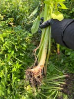 At the start of Queen Victoria’s reign Himalayan Balsam was introduced as a garden plant. Having escaped the garden the plant is now impacting and out-competing native species in our wetland areas and thus it is affecting native insects, animals and birds. It is listed under Schedule 9 of the Wildlife and Countryside Act 1981 and it forms part of our check when carrying out a Stage 1 site investigation for any site. All our staff are trained in its identification along with other such plants as Japanese Knotweed and Giant Hogweed.
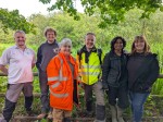
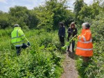
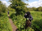
Last Friday we closed the office and joined the RSPB at Lochwinnoch to clear areas of the Himalayan Balsam - part of our ongoing efforts to improve the environment and help local communities and organisations. On Friday the weather stood fair and a good time was had by all.
