Wee Notes & Breaking News
These are William’s notes and comments as the year progresses.
Introducing Rachel Allen - Associate Director
 Rachel Allen BSc (Hons) FGS
This month, we are proud to announce that Rachel has taken on the post of Associate Director with Terrenus Land & Water Ltd.
Rachel started her professional career as a geologist back in 1989 with Thorburn Consulting Engineers where she met and worked with William. Since then Rachel worked with Terrenus and BAM Ritchies prior to coming back to Terrenus in 2018, building up a considerable portfolio in the management and delivery of client projects, on time and on budget.
While Rachel’s technical expertise lies in geo-technical engineering, she has a particular interest in the analysis of client needs concerning ground investigation, mining, contamination and, more recently flood risk. Rachel is an excellent communicator with our clients, building strong relationships based on trust.
Rachel believes that problem solving and the search for robust, economic designs and remedial measures is principally achieved through motivated people backed up with appropriate skills. Working closely with staff members, in addition to benefiting the company, this allows our staff to achieve their full potential.
Himalayan Balsam - the root of the problem
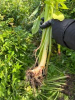 At the start of Queen Victoria’s reign Himalayan Balsam was introduced as a garden plant. Having escaped the garden the plant is now impacting and out-competing native species in our wetland areas and thus it is affecting native insects, animals and birds. It is listed under Schedule 9 of the Wildlife and Countryside Act 1981 and it forms part of our check when carrying out a Stage 1 site investigation for any site. All our staff are trained in its identification along with other such plants as Japanese Knotweed and Giant Hogweed.
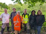
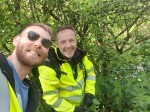
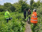
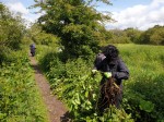
Last Friday we closed the office and joined the RSPB at Lochwinnoch to clear areas of the Himalayan Balsam - part of our ongoing efforts to improve the environment and help local communities and organisations. On Friday the weather stood fair and a good time was had by all.
Hard Hat Talks from Block Architects.
A few weeks ago I was invited by Kenneth Martin of Block Architects to take part in his ‘Hard Hat Talks’. These interesting pieces aim to be ‘No Fluff. Just Real Industry Conversations’ and entail a chat between Kenneth and a guest.
Episode 3: Flood Defence to Land Restoration is now out and I invite you to have a look and listen.
The Hard Hat Talks Podcast - Real Discussions Shaping the Industry
Free Lunch!
They say that there is no such thing as a free lunch and, depending on who you ask in Terrenus, I may agree with you. On a regular basis we have ‘Lunch and Learns’ where for the chance of food we meet and learn from one of our own about a technical subject. This week we are having no less that two events - the first was today and concerned WAT-PS-10-02. This may not mean much to many people but if you are considering developing a Brownfield site you should get to know it. SEPA has updated its guidance on the assessment of groundwater and this will have big impacts. I will post an in-depth briefing soon so watch this space.
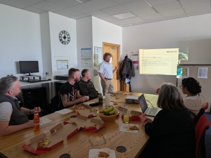
The second meet will be about SMART decision making - I think that we are going to need a bigger pizza.
Off to site.
One of the prices of seniority in any organisation is that you reduce the opportunity to get out and do some of the things that drew you to the job in the first place. Some of my fondest memories at work were in the early days with a van going round the country organising and managing multiple site investigations. If you play your cards right you can use the travel as ‘downtime’ where you listen to the radio and more or less relax. True, the downside is that your office is the steamed up van on a wet day when your note book has turned to mush and the borehole location drawing looks like something regurgitated by the nearby cow but the pleasure is real none-the-less.
This week I have the chance to undertake a wee sojourn to Wigtownshire for a site walk over in preparation for a 2D fluvial hydraulic model. The development is for glamping pods on land which, presently, the SEPA Flood Map indicates possible flooding. Our hydraulic models are more accurate that the SEPA ones (due to them being site specific) and our aim is to allow the development to proceed safely, free from the risk of flooding and without increasing the risk elsewhere. Without our input the job will simply not go ahead although we still need our client to be flexible regarding the site layout - the motto is “get us involved even before you get the architect involved”.
So, being somewhat rusty, today I am now getting briefed by our Jonny Simpson in the use of our survey staff which will allow us to ‘truth’ the local LiDAR dataset which will form the basis of our hydraulic model.
More of the site visit next week perhaps.
